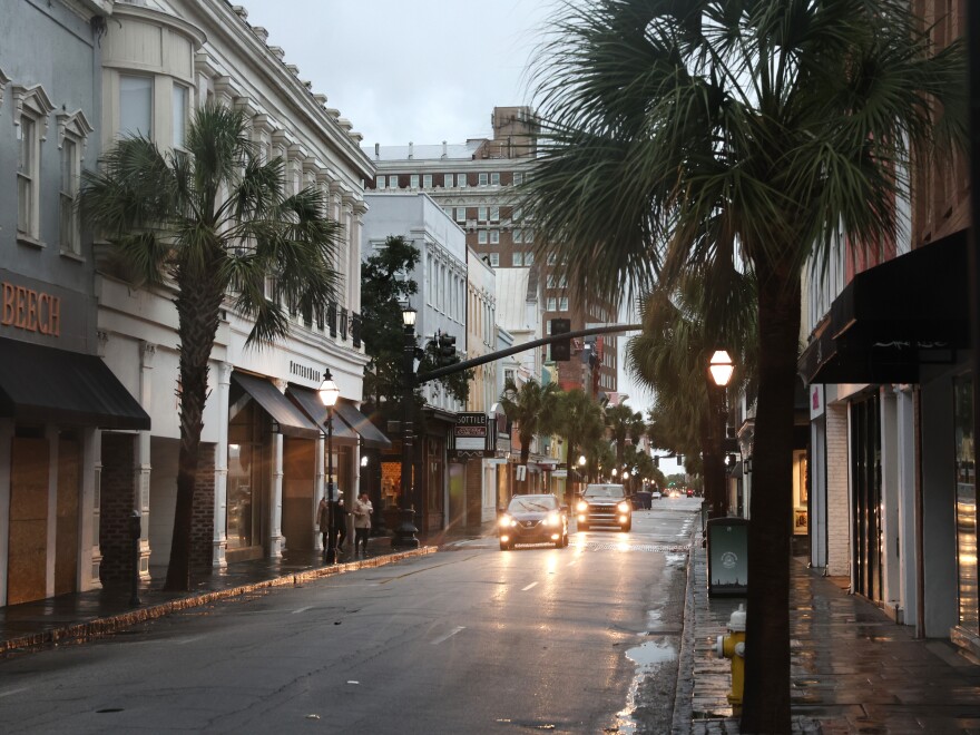
Hurricane Ian isn't expected to make landfall in South Carolina until this afternoon, but flooding has already forced road closures in Charleston's historic downtown, and winds near the city are gusting at hurricane speeds.
It's the latest impact of the storm that inundated wide sections of the Florida peninsula — and Ian is expected to bring power outages and flooding to South Carolina and southeastern North Carolina when it makes landfall Friday afternoon.
A hurricane warning now covers all of the South Carolina coast and part of the North Carolina shore up to Cape Fear — meaning hurricane conditions are expected within that area.
Hours ahead of Ian's arrival, a weather buoy in the ocean 41 nautical miles southeast of Charleston recorded winds of about 75 mph, with waves as tall as 21 feet, the National Weather Service said. Earlier this week, no waves at the buoy measured higher than 4 feet.
Coastal communities again brace for Ian's storm surge
The latest forecast track predicts Ian will make landfall northeast of Charleston, between the port city and Myrtle Beach. A large swath of the coast could see storm surge waters reach 6 feet above ground, with more than 9 feet possible in some spots.
Charleston County, which includes around 100 miles of coastline, has declared an emergency and opened shelters for people who want to sit out the storm in safe spaces and higher ground. But the county had to halt bus service to shelters on Thursday, when high winds made those trips risky.
Just north along the coast, Georgetown County urged people in flood-prone areas to keep an eye on weather warnings — but in contrast to Charleston, the county said on Thursday that it has no plans to open shelters. It also eschewed other steps, such as offering sandbags, saying people can buy them at stores.
There is no evacuation order in effect, but residents in low-lying and flood-prone areas should keep a close eye on conditions. #HurricaneIan pic.twitter.com/1ENpmTBqpA
— Georgetown County, S.C. (@GtCounty) September 29, 2022
"Widespread areas will suffer from power and communication outages," the NWS office in Wilmington, N.C., said. It expects other impacts to range from trees snapped off or uprooted, debris blocking roads and bridges and high roads becoming unsafe.
Flooding started in the predawn darkness
Much of the Charleston metro area is under a flash flood warning that was issued around 6 a.m. ET. It lasts until noon — and then the hurricane will arrive.

As of early Friday, the closures were mainly on low-lying streets that are prone to flooding, the Charleston Police Department said. Road closures are scattered around the city, from the central intersection of Huger and King streets to roads along the waterfront.
"We urge only essential travel," the police department said.
In downtown Charleston, some roads started flooding before dawn, as Ian's heavy rain bands dropped 1 to 2 inches of water on the city, according to the National Weather Service office in Charleston. Another 2 to 6 inches of rain could fall, it warned.
"As tide levels increase and rain intensifies, areas of flash flooding are likely to develop ahead of Hurricane Ian," the NWS office stated.
Flash flooding is expected to hit a number of popular tourist areas, such as Folly Beach to Sullivans Island and Isle of Palms. Further inland, floods will also likely hit North Charleston, the office said.
As of late Thursday, the city said, people hoping to keep their cars safe from floodwaters had filled the city's parking garages.
Copyright 2022 NPR. To see more, visit https://www.npr.org. 9(MDA4NDQ1MjMzMDEzMjA3NzExMTA5OTU5Yw004))


